

Chinese and Hungarian universities join forces to help predict floods, droughts and water quality problems
The Sino-Hungarian water security cooperation can contribute to faster prediction of extreme hydrological situations and crises, disaster prevention and efficient water management using artificial intelligence, remote sensing and satellite observations.
On March 25 and 26, 2026, the Institute of Environmental Sustainability of the National University of Public Service (NKE) and the International Research Center of Big Data for Sustainable Development Goals (CBAS) of the Chinese Academy of Sciences organized a joint scientific workshop at the Ludovika Campus, Budapest. Our questions were answered by Gretchen Kalonji, head of the Chinese delegation, and Tibor Bíró, head of the Institute of Environmental Sustainability of the National University of Public Service.
What kind of special knowledge could a small country like Hungary have that would lead China to sign a scientific cooperation agreement with us on water security?
G.K.: Hungary has developed considerable capacity in sophisticated mathematical approaches to real-time forecasting of water-related hazards, including floods and droughts. These include models which combine hydrodynamics and stochastic processes in powerful learning algorithms. Coupling these modelling approaches with the enormous remote sensing capacity available from the Chinese side, as well as the remarkably rapid developments in AI in China, has the potential to significantly enhance our collective ability to more effectively address these challenges. Simply put, through working together China and Hungary have the potential to strengthen our combined capacity to address critical water-related challenges which are global in scope, and to provide significant new contributions to the global scientific community.
Because of its history, geography and economy, Hungary, though a very small country, has some very powerful lessons to offer, in terms of models for water cooperation, both within its borders and on a trans-national basis. These lessons, if effectively captured, can be of utility to China, and, in fact, globally.
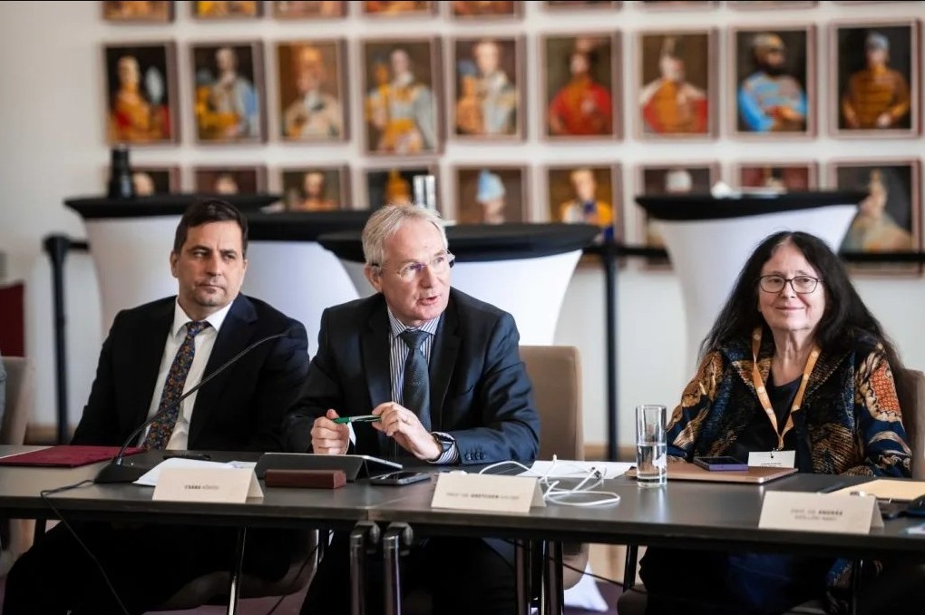
In the middle: Csaba Kőrösi, Strategic Director of the Blue Planet Climate Protection Foundation; on the left: Gretchen Kalonji, Special Advisor of the International Research Center of Big Data for Sustainable Development Goals (CBAS). Photo: Dénes Szilágyi, NKE
Tibor Bíró University professor and Head of the Institute of Environmental Sustainability at the National University of Public Service in Budapest, water and environmental management expert with over thirty years of teaching and research experience. His research focuses on adaptive water management, environmental assessment, water quality regulation and remote sensing. Formerly Dean of the Faculty of Water Sciences and Project Director at the National Laboratory for Water Sciences and Water Security. Currently Vice-President of the Hungarian Hydrological Society and Vice-President of the Scientific Committee of Water Management in Hungary.
Gretchen Kalonji Special Advisor and Head of Delegation at the International Research Center of Big Data for Sustainable Development Goals (CBAS). She is an internationally recognised scientific leader with a long track record in developing scientific collaborations and innovations in higher education. She was previously Deputy Director-General for Natural Sciences at UNESCO, where she was responsible for several global scientific programs. Prior to joining CBAS, she was Dean of the Institute of Disaster Management and Reconstruction at the Sichuan University–Hong Kong University of Science and Technology.
How similar are the water problems of the two countries? How can we help each other?
G.K.:Of course, China is a gigantic country compared to Hungary; almost any “water problem” that can be imagined can be found some place or at many places in China. In developing the partnership led by the Ludovika University of Public Service (LUPS), on the Hungarian side, and by the International Research Center of Big Data for Sustainable Development Goals (CBAS), on the Chinese side, we identified three main broad topics of common concern on which to focus. These are: floods, droughts and water quality. Together with impressive contributions from multiple institutions in Hungary, which were brought together in our workshop through the leadership of LUPS, sub-groups developed initial and quite concrete plans of action for developing China-Hungary collaborations.
The sub-group on flood protection has designated Magyaregregy in Hungary and the Haihe River and Poyang Lake in China as a pilot catchment area for the development and validation of remote sensing-based forecasting methods for the development of so-called distributed catchment models. These models can help reduce the impact of intense rainfall events.
The sub-group on drought assessment and forecasting has also prepared a comprehensive initial research plan, including the development of new water scarcity indicators to enable early warning and water management responses. A new satellite soil moisture database with higher spatial resolution is also planned. Technologies are also being introduced that can measure both surface water and groundwater levels and their changes.
The sub-group on monitoring and assessing water quality changes has developed a detailed plan for a comparative study of water quality in river systems and lakes. This includes, among others, the prediction of algal blooms, the study of the impact of climate change on lakes (in Lake Balaton and Lake Taihu in China), and the monitoring of river water quality. In addition, an integrated observation and prediction platform is being developed, which works with Earth observation, artificial intelligence and digital technologies.
What data could be the most important to monitor in terms of extreme weather events related to climate change?
B.T.: Remote sensing can help monitor changes on Earth and predict events in many areas. Measuring surface temperature is important in itself, but it is also key to estimating evaporation. Data collected by multispectral satellites is useful for mapping plant water stress and determining surface vegetation cover. For example, overgrowth on floodplains plays a role in flood formation. Satellites equipped with microwave sensors can survey water-covered surfaces. Airborne laser surveys are currently the most effective method for terrain modeling, which is crucial for predicting runoff processes.

Tibor Bíró at a meeting held at the Ludovika University of Public Service (NKE). Photo: Dénes Szilágyi, NKE
Representatives and experts from Hungarian research institutes and water organizations also participated in the workshop last week. Who are they and what tasks might they have?
B.T.: The workshop brought together leading experts from across Hungary. Our goal is to integrate existing knowledge and build capacity. The University of Debrecen excels in terrain modeling and vegetation mapping, and the University of Szeged is renowned for its drought monitoring capabilities. The Institute of Soil Science is the best at soil mapping. The development team at the KITE company is invaluable when it comes to interpreting plant water stress. Ludovika University of Public Service can make significant progress in predicting algal blooms in collaboration with the Limnological Research Institute. The Budapest University of Technology and Economics will be the partner in flood forecasting. Water management administration (directorates and directorate-general) is also playing a part in this joint effort. Given their experience and expertise in operating the drought monitoring network and managing floods, this collaboration is poised for success.
Are there any plans to involve other countries?
G.K.: Involvement of other countries has been, from the very beginning, essential to our strategic planning. Both the Hungarian and Chinese side already, of course, have many extensive multinational partnerships. And these partnerships overlap in many positive ways. In terms of international and intergovernmental networks, we share many powerful connections. For example, through UNESCO, both sides work closely with the Intergovernmental Hydrological Program (IHP), as well as with the network of UNESCO-affiliated research centers worldwide, and the network of UNESCO Chairs. It is notable that LUPS hosts the UNESCO Chair in “Water Conflict Management”, with which the Chinese side is hoping to work closely.
The Chinese side also is counting on LUPS to take the lead on developing additional fruitful collaborations in Central and Eastern Europe. More broadly, CBAS has a strong strategic regional prioritization both in Africa, in central Asia, and in Small Island Developing States (SIDs). The prospects of leveraging the China-Hungary partnerships to multiple other regions are very significant.
What do you expect from the agreement in the long term?
G.K.: Our expectations are very ambitious. We hope to leverage the work of this partnership, focussed on Earth observations, AI and big data for inclusive, climate resilient, and sustainable development to make substantive contributions to sustainability transformations worldwide, through pioneering new models of scientific collaboration.
Source: Greendex